The Hudson Valley may not be so fortunate early next week as a Nor'easter is expected to slam the region.
The National Weather Service said in a Hazardous Weather Statement issued early Saturday morning that the "potential is increasing" that the storm will bring "significant snowfall and strong winds" to the area late Monday night or early Tuesday morning into late Tuesday night, with some snow continuing into Wednesday morning.
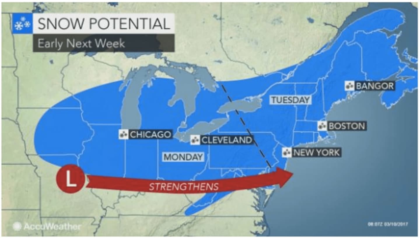
"There is the potential for a major snowstorm, and possible Nor'easter, from New York City to New England spanning Tuesday and Tuesday night," said AccuWeather.com Senior Meteorologist Henry Margusity.
Unlike most of this winter, the storm will have access to plenty of cold air and will follow some of the coldest weather of the winter in the Northeast this weekend, AccuWeather said.
Disruptions to travel and daily activities may develop Tuesday and Tuesday night and last into Wednesday.
The storm system will be preceded by bitterly cold days Saturday and Sunday.
Saturday and Sunday will be partly sunny with a high in the upper 20s and wind-chill values between zero and 10.
Monday will also be brisk with a high struggling to reach the freezing mark under partly sunny skies.
Snow is expected to arrive very late Monday night or in the early morning hours Tuesday with snow heavy at times during the day and snow showers lingering into Wednesday.
The exact track of the storm remains uncertain. Be sure to check back to Daily Voice for updates.
Click here to follow Daily Voice Bedford and receive free news updates.