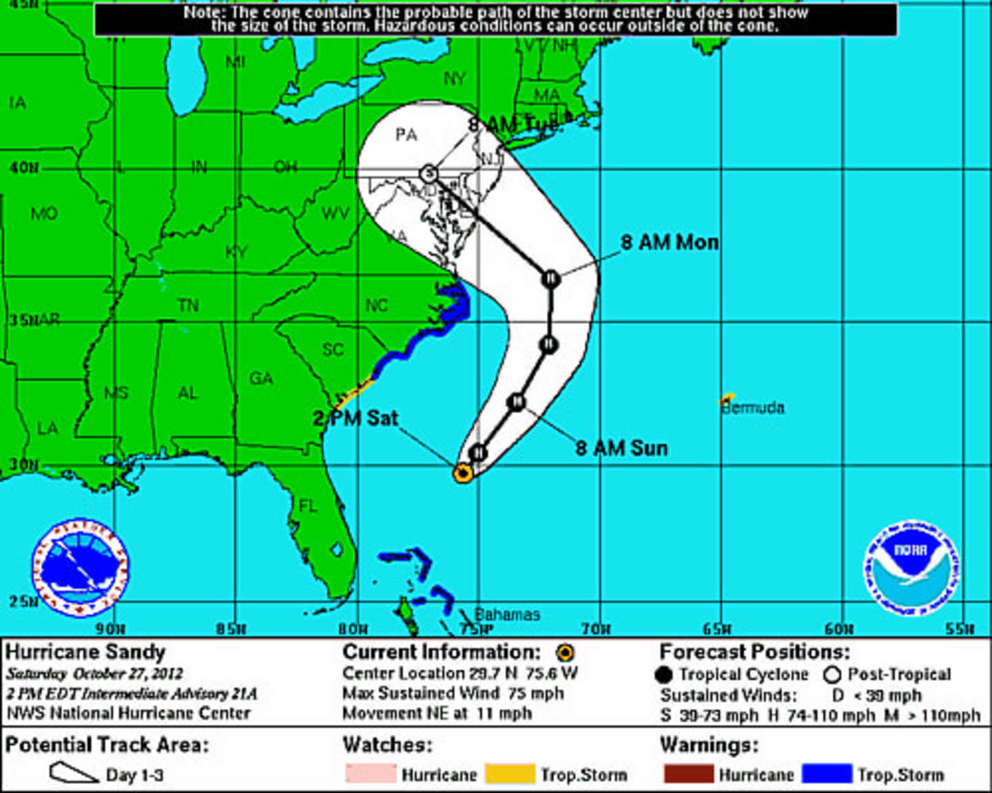
As of late Saturday afternoon, Sandy was a Category 1 hurricane traveling about 75 miles per hour along the east coast of Florida. The storm is expected to be about 500 miles wide when it makes landfall early Tuesday.
Rain from the storm is expected to start Sunday before midnight with winds of 24 to 28 mph developing Monday. Heavy rains and wind are expected to continue into Tuesday night before dissipating Wednesday. Tropical storm conditions are likely.
The National Weather Service is predicting significant urban, small stream and river flooding as well as high winds capable of downing trees and power lines in the coming storm.
Click here to follow Daily Voice Bedford and receive free news updates.